Friday, November 27, 2015

Arkansas Vacation (cont.)

Wednesday, September 30

The town of Mountain Home, Ar. sits between two reservoirs.  To the east is Norfork Lake (on the North Fork of the White River) and to the west is Bull Shoals Lake, by far the larger of the two lakes.

The morning was a little overcast, breezy and cool enough for us to put on an extra layer for our outdoor adventures today.  
Bull Shoals Dam was created to impound the White River by one of the largest concrete dams in the United States and the 5th largest in the world at its inception.  Work on the dam began in 1947, was completed in 1951 and dedicated by Harry S Truman in 1952.  At least seven small family cemeteries and 20 larger cemeteries were meticulously relocated to accommodate the new lake.  The many miles of shoreline of the lake are totally undeveloped and protected by a buffer zone owned, operated, managed and controlled by the Army Corp of Engineers.  However there are several developed parks around the shoreline that provide campgrounds, boat launches, swim areas, and marinas. 
We toured the beautiful and informative Visitor Center that sits atop a hill overlooking the Bull Shoals Dam.


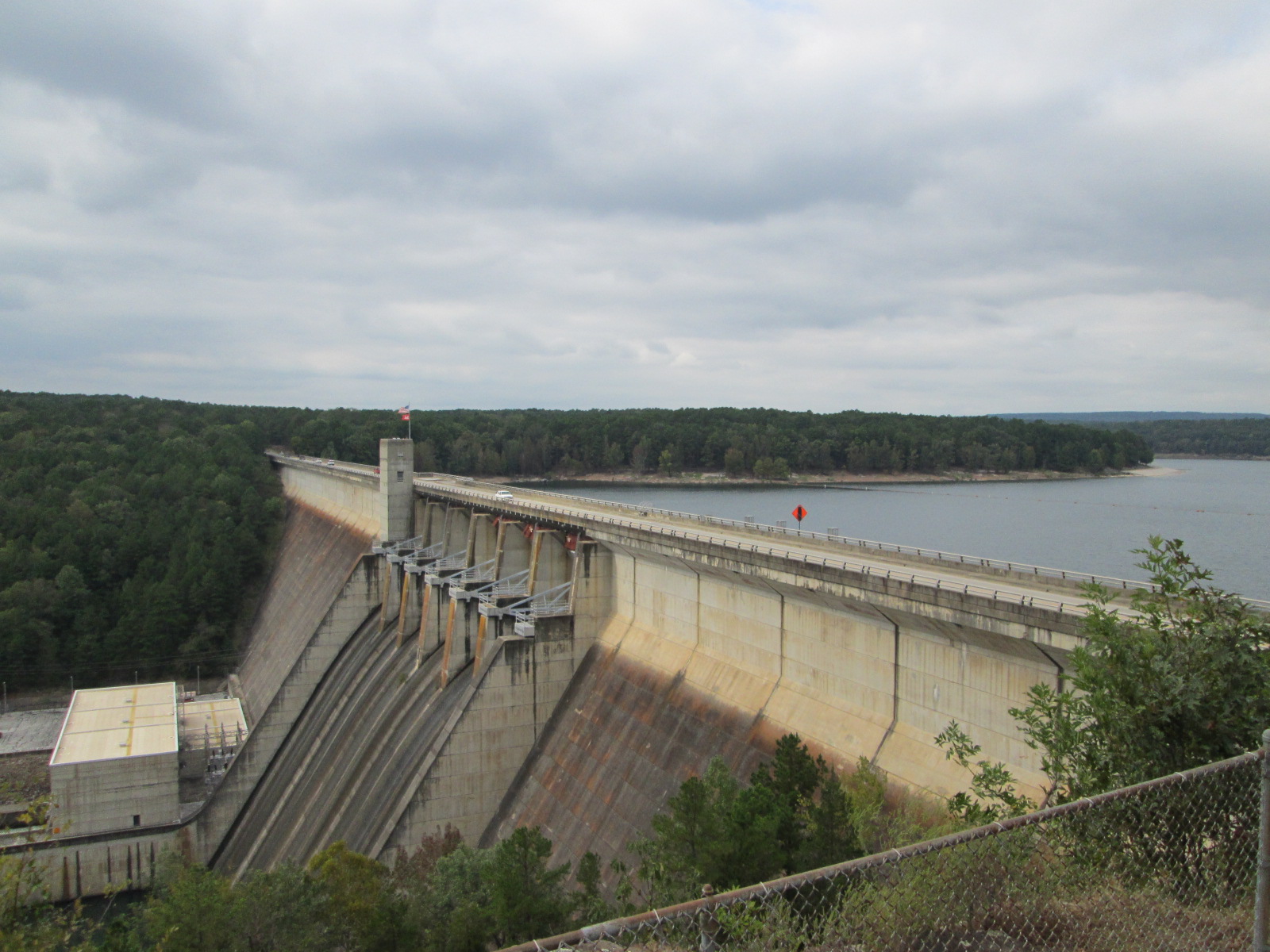
The views back across the dam and rugged shoreline were stunning.


We walked the short interpretive Nature Trail next to the Visitor Center and met up with a guided group of teenage schoolgirls who were on a field trip for the day.

We then headed south, passing through the small towns of Flippin and Yellville before dropping down to the Buffalo River valley.  The free-flowing Buffalo River is nestled in the Arkansas Ozarks.  How did this river escape impoundment, impairment, and massive change?  To preserve the Buffalo River as a free-flowing stream, Congress designated it as America's first national river in 1972.  Originating high in the Boston Mountains, the Buffalo drops steadily to its confluence with the White River 151 miles to the east.  The gradient is steeper and the water is faster on the upper river, but the river levels out and slows down over its course.  Long, quiet pools between rapids disguise its vertical fall.  We do not have the time for exploring (or possibly rafting/canoeing) while on this vacation but the Buffalo River is surely a place we would like to come back to someday.

We did stop at the Buffalo Point Ranger Station and watched a video about the history, life, challenges, and incredible views along the picturesque river. 
We went to Buffalo Point overlook but did not tarry long because the gnats were swarming so thickly it was not very enjoyable.  There were a couple of motorcycle guys there with their portable cook stove set up on the picnic table, battling the gnats while trying to boil some water.  Better them than us!
We crossed over the Buffalo River.............
......continuing south along Hwy. 14 toward Mountain View, before detouring to Blanchard Springs.
 We skipped the Caverns and opted instead to visit Blanchard Springs.  Rainwater falling on the Ozarks has soaked into the ground for millions of years.  As it moved thru cracks in the limestone bedrock, it dissolved the stone and slowly widened the cracks to form Blanchard Springs Caverns.  The water remained in the caverns until surface erosion carved valleys and allowed the water to escape.  We are in such a valley now.  As this valley cut deeper and deeper, lower sections of the cave were drained.  New springs then developed below older dried-up springs.  Blanchard Springs probably came out of the holes high on the bluff above us many years ago, when the streambed lay 20-30 feet above it's present level.

 We stopped and sat on the large rocks beside the Springs to have a snack. 

What a gorgeous setting!  We decided to walk the trail along the edge of the stream as it traveled toward Mirror Lake.


The Mirror Lake Dam was constructed by the CCC, Camp Hedges-Company 743, in 1940.
What an incredible sight as we stood on top of the Dam watching the water pour over.
Mirror Lake is so serene and pretty deserted on this day.  We did spot one fisherman across the way.
We continued along the trail past the Dam until we found a spot we could rock-hop across stream.
On the other side is the remnants of an old abandoned mill.
Down by the old Mill Stream.....is Mitchell Mill, originally a two-story structure built of oak and walnut.  With the mill, Steve Mitchell provided ground corn and ginned cotton from 1900 until 1928.  After Mr. Mitchell died, his family sold the property to the Forest Service.
The rock foundation and walls were added by the Civilian Conservation Corps in 1942.  Exquisite rock work is the hallmark of the CCC, a post-Depression program to put young men to work.  Their plan was to restore the mill to an operational condition, but the work was interrupted when the CCC was disbanded at the onset of World War II.

After checking out the remnants of the old mill, we hiked back to our car, stopping to check out the restored walkway atop the dam.

Fall wildflowers blooming along the path.


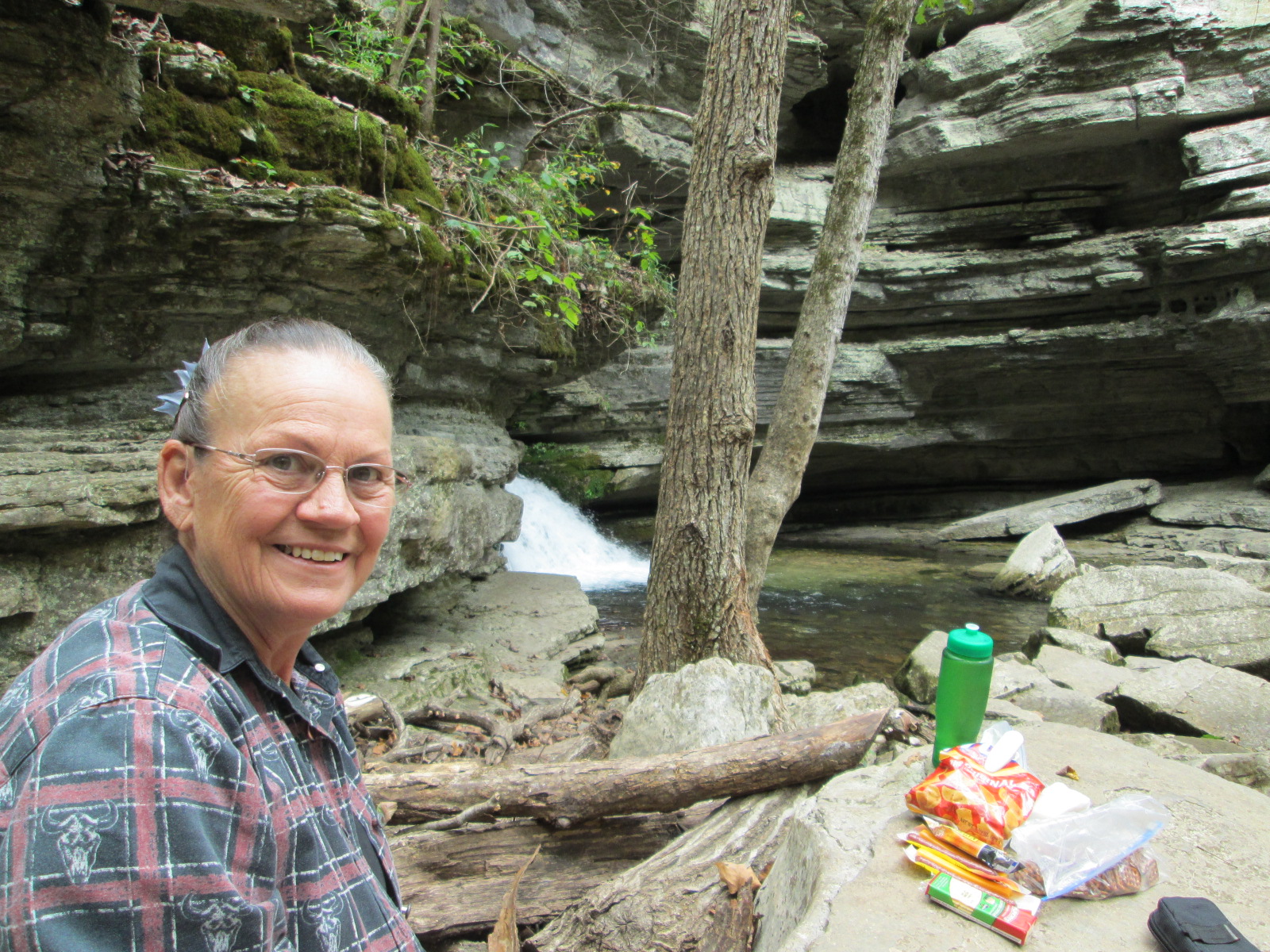
What a great "find" Blanchard Springs has been.  We thoroughly enjoyed our time there.

We then continued south, passing through the small town of Mountain View which is the county seat of Stone County.
 
Our destination for today is Greer's Ferry Lake where we plan to tent camp again tonight.
The highway goes right across the top of the Dam.
We continue on into the town of Heber Springs, which is the county seat of Cleburne County, looking for a campground.
We end up going back to the dam to a campground right on Greer's Ferry Lake.
It is an incredibly beautiful setting and the weather is perfect.
We hike down to the water's edge......
.....Tom is building a rock cairn......
...while a flock of ducks/geese fly by overhead.....
....a very precarious rock cairn.  A fun challenge!

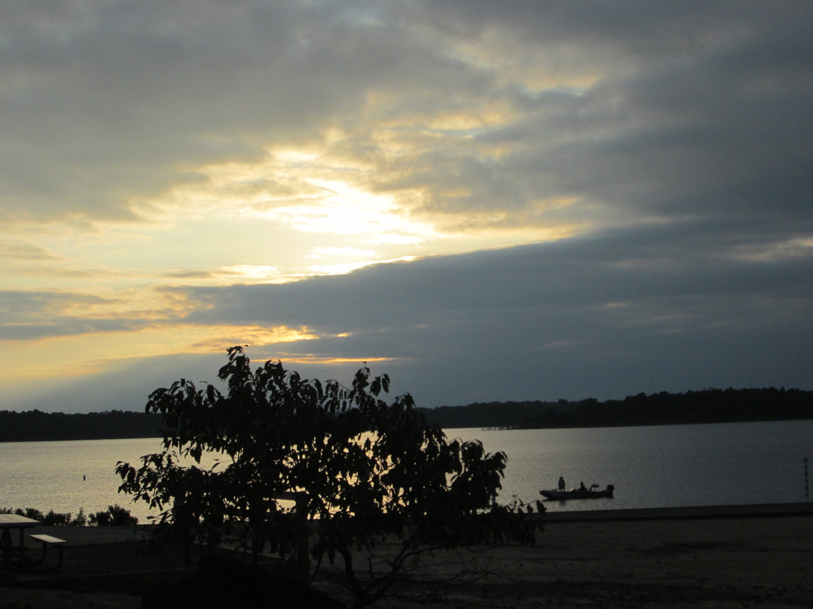
We watch in awe as the sun is setting across the water.  So peaceful and quiet here.

This is a huge and very spread-out campground and there is hardly anyone here but all the roads leading in to the sections for tent camping have a bar across the road so you can't "drive" to any of the campsites.  But we decide to pitch our little tent in a campsite right next to the showers/restrooms building.  This being a Wednesday night and the campground being practically deserted we don't anticipate anyone coming along to check or make us move. 
After pitching our tent I walked over to the parking area for the restrooms and looked back to see if we were very visible and I could barely see our tent so I pray we'll be fine tonight.
Another adventuresome day in Arkansas!
 

Monday, November 16, 2015

Eureka Springs (cont.)

Tuesday, September 29

We slept well in our little tent at the Kettle Campground.  We were up early and drove the short distance to McDonalds to grab coffee and breakfast.  It is a bit cooler today than it was yesterday so when the Goodwill Store opened Tom found himself a light windbreaker.

We then went to the Eureka Springs & North Arkansas Railway Depot to check on getting tickets for the Noon Excursion Train.  We wandered among all the old railway cars and machinery.


This old roundhouse turntable is from yesteryear!


After securing our tickets we went to the Eureka Springs Transit, purchased our $6 day pass for the Transit System.  We took the transit, then jumped off at the edge of town and proceeded on our own walking tour.  We saw this awesome sculpture/fountain in someone's yard.

Next we happened upon this incredible Music Park!  We walked under this and played the wind chimes.... 
...walked around this one and used the supplied hammer gong...
....Tom is playing the xylophone.  Too cool!
 
Then we walked up the hill to Magnetic Spring. 
There was beautiful landscaping surrounding the grotto housing the spring.

We jumped back on the Transit to go downtown to the Museum which is in one of the many really old buildings in Eureka Springs.  The history of Eureka Springs is very well presented in the museum.


The old Crescent Hotel is one of the many attractions in downtown.
We really enjoyed the usefulness of the Transit System.  We each had a $6 all-day pass and that beat having to drive and try to find a parking spot.


Once again we traveled on the City Transit back to the Depot when it was time for our train excursion.  Our Conductor/Tour Guide for our train excursion, Travis, was very knowledgeable about the history of the railroad in this area, he loved telling us lots of stories from the past, and showed obvious dedication to his job, along with having a way with the ladies!  (all in fun, of course)


These old train seat backs flipped back and forth depending on which direction the train was traveling.
As we headed away from the station we passed by what looked to be a railroad graveyard of old derelict cars.


                       This is the scenery ahead of us.
When we reached the end/turnaround point the brakeman exited the train to manually switch the rails.

The train stopped and Travis told us we could get off the train if we would like to have a little fun!

Then those that wanted to participate could lay a coin on the rail....
.....then let the train roll back over the coins to flatten them.  The before and after of Tom's nickel!  Fun stuff!
Then we re-boarded the train and headed back to the Station.

After our train excursion we left our car parked at the Train Station and caught the Transit to take us out to Lake Leatherwood City Park so we could do a short day hike.  When the Transit driver dropped us off he said he would be back in about 30-40 minutes so we figured we could walk out 15-20 minutes then turn around and come back.  We could see the Dam from the transit stop so off we went down the trail thinking we could make it to the Dam and back and catch the Transit on its second loop. 
The trail was well trodden and easy to follow, some places a little challenging but overall a pleasant walk.
Well it took us a good 45 minutes to make it to the Dam, so we knew we were going to have to hoof it pretty fast to make it back to catch the transit on its last loop of the day.


We walked as quickly as we could, up, down, and around and worked up a sweat by the time we made it back.  We had been gone an hour and ten minutes.  (Unbeknown to us we had just walked four miles on the Fuller Trail!)  Hope we haven't missed our ride!  We sat on the grass, looking out over the lake, enjoying the end of our action filled day in Eureka Springs.  Ahh, we hear the Transit coming!  Yippee!
 
When we arrived back to our car at the Train Station, we decided we were ready to head east to Mountain Home, Ark., find a hotel room, get a good night's sleep, and be ready for another day of vacation tomorrow.