Before Tom and I left home on this vacation, we made our hotel reservations through Thursday (May 2). We knew we would be visiting Bryce Canyon on Thursday, but weren't too sure how the remaining three days of this trip would play out, not sure of our route, not sure about how many more Parks, Monuments, or Historical places we would have time for. So when we left our hotel at Bryce Canyon on Friday morning, in the crisp, cold, sunny weather, it was a truly gorgeous day for a drive! We were pleasantly surprised at the incredible beauty of Capital Reef National Park, which before this trip we had really never heard of this Park. We are headed east on Utah Hwy. 24, the Capital Reef Country Scenic Byway. Again this is a such a remote section of our country, we see few vehicles on the road this morning, and fewer towns. Majestic views are plentiful as we travel toward Hanksville, passing thru only one "town", Caineville, on this long stretch of highway.


We finally reach Hanksville, which isn't much of a town, but mainly a highway intersection, where we will head south on Utah Hwy. 95, the Trail of the Ancients Scenic Byway. At the Highway Junction is the Hollow Mountain Station, complete with a store built into the side of the mountain (completely underground). How could we pass this up, we had to stop!
We are loving having the Utah Road Atlas which gives us the names of every mountain, gully, mesa, creek, wash, etc., and shows all the roads, even the unpaved ones (with these warnings "Roads may be impassable when wet").
This past Tuesday, after we left the Grand Canyon, we went thru Page, Arizona, and across the Colorado River at Glen Canyon Dam, at the south end of Lake Powell, which is one gigantic (long) lake! Well, today we will be once again crossing the Colorado River, as the Dirty Devil River flows into it, and subsequently both flow into the very north end of Lake Powell, many miles north of where we were on Tuesday. En route to this, we are traveling along side the Henry Mountain Range, just west of Highway 95. This will likely be the last glimpse of snow-covered peaks we will see on this trip.
(Sorry about the reflection in the windshield of the car; I am taking these photos as Tom is driving along!) We still see few vehicles on this road this afternoon. I would not want to have "car trouble" out here; might be a while before anyone came along to render assistance. Here is where the Dirty Devil River flows into the Colorado River.
Next we cross the big Steel Bridge that goes across the Dirty Devil River.
Just before we get to the Bridge, we look to our right, up on a tiny, flat spit of rocky ground, this small airplane is taking off!
We have not seen any kind of a town or small settlement since we left the Hollow Mountain Store near Hanksville this morning. However, we know from our Utah Road Atlas that we will soon be to Natural Bridges National Monument. We take the Park Road 275 to the Visitor Center, where we pick up a brochure about the Park, and decide to drive the one-way loop (9 miles) thru the Park, stopping at each Bridge viewpoint.
"Million of years ago these sandstones were deposited and then slowly uplifted as part of the Colorado Plateau. Erosion gradually formed today's canyons and landscapes. Natural bridges are formed by the erosive action of moving water. Arches are formed by other erosional forces-mainly frost action and seeping moisture-that also enlarge natural bridges once stream erosion forms them."
Our first stop is at the Sipapu Bridge (220 ft. height, 268 ft. span, 31 ft. width, 53 ft. thickness.)
Our next stop is the Kachina Bridge (210 ft. height, 204 ft. span, 44 ft. width, 93 ft. thickness).
Our last stop on this 9-mile loop is the Owachomo Bridge (106 ft. height, 180 ft. span, 27 ft. width, 9 ft. thickness).
It was a short hike/walk, from the parking area, on a nice pathway to view each bridge. The mighty power of water is truly phenomenal!
We left the Park, and kept going south on Utah Hwy. 95, and saw this. Aptly named, don't you think? Bears Ears!
Next we reached the Jct. of U.S. Hwy. 163 & 191, just south of Blanding, Utah. We took the shortest route we could find to get Montezuma Creek where we would pick up Hwy. 162 that would take us to the Colorado border and Colorado Hwy. 41 south to U.S. Hwy. 160 west to Teec Nos Pos, Arizona, where we would head back east again toward Shiprock, New Mexico on U.S. Hwy. 64! You see, we are trying to get to the Four Corners Monument, the only place where four States actually touch, at one point! We barely made it to the Monument before they closed and locked the gates!
Tom and I both used our hands and feet to be in all four states at the same time. This monument is located within the Navajo Indian Reservation, and I'm sure it is a "happening place" on weekends, holidays, and during tribal celebrations, with the many vendor booths that surround the Monument.
It is getting late in the day, we are running out of daylight, and we have traveled a long way today and seen such beautiful sights and enjoyed the remoteness of the awesome beauty that abounds in southeast Utah. Now we are looking for a place to lay our weary bodies and get some rest, get a hot shower, and a good night's sleep!
Our goal is to get to Farmington, New Mexico tonight, and maybe make it all the way home tomorrow! On our way into Shiprock, New Mexico (29 miles before Farmington) we see the "Rock" that gave this town its name!
Of course, we are a good ways away from it so we cannot fully appreciate its height, 7,178 ft., but it does resemble a "Ship"!
Homeward bound tomorrow!
Last night, we stayed at a hotel just outside the entrance to Bryce Canyon. When we woke up this morning, it was 19 degrees! Brrrrrrrrr! We are ready to get back to Texas and some warmer weather!
Today we are traveling thru some of the last-settled land in Utah. Not until the 1950's was there a paved highway thru this remote area of the state. We pass thru the very small towns of Tropic, Cannonville, and Henrieville on our way to Escalante, Utah. This sparsely populated, rugged landscape is all part of the Grand Staircase-Escalante National Monument. The road between Escalante and Boulder is called the Journey Through Time Scenic Byway. One section thru the most rugged area is called the "Million-Dollar Highway". The views all along the way are so awe-inspiring!
We are headed to Capital Reef National Park this morning, and we are really enjoying this remote section of Utah while traveling there. Unbelieveably remote and desolate, but also such rugged beauty abounds.
"Capital Reef National Park is a giant buckle in Earth's crust and stretches across south-central Utah. This vast warping of rock, created 65 million years ago by the same great forces later uplifting the Colorado Plateau, is called the Waterpocket Fold. Capital Reef National Park preserves the Fold and its eroded jumble of colorful cliffs, massive domes, soaring spires, stark monoliths, twisting canyons, and graceful arches. The world of the Waterpocket Fold stretches 100 miles--and beyond." (This is the description found in the Capital Reef brochure from the National Park Service.)
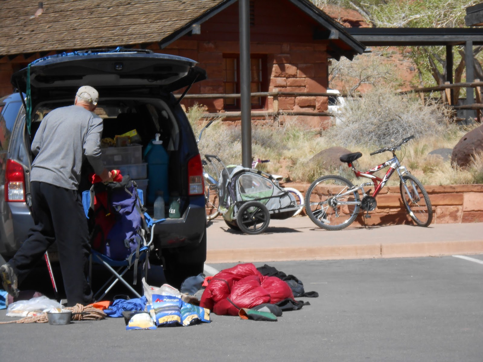
When we pulled in to the Visitor Center, I got a kick out of this guy who had "exploded" his backpack onto the parking lot, in an attempt to get himself organized!
After leaving the Visitor Center, we toured the Gifford Farmhouse, depicting what life was like over a hundred years ago, and took a short walk along the Fremont River which flows thru the Park. Then we drove the 8-mile paved Scenic Drive thru the Park.
However, the real fun began at the end of the 8-mile paved road! We decided to continue down the gravel/dirt road into Capital Gorge! Oh my goodness, I was driving at the time and I was a little terrified at how narrow the road was, winding thru the immense canyon walls soaring up into the sky! I hope we don't meet anyone coming from the other way. Probably not, because we are probably the only tourists who have ventured down this "skinny" road winding ever deeper into Capital Gorge!
What spectacular scenery around each curve of the Canyon! What a surprise when got to the end of the gravel/dirt road! We were not alone after all!!
Our little red Chevy Cobalt is dwarfed by the Canyon wall!
Yes, there is a small gravel parking area where the road ends, and it was full of other curious tourists just like us! Also a picnic pavillion, and a small building with a composting toilet! There is a hiking trail that continues on deeper into the Gorge from here. It is amazing to see these flowers in such a barren rocky landscape struggling for survival!
Now we must retrace our route on the gravel/dirt road (Tom's driving now!)to get back to where the paved Scenic Road ended. We meet several tourists who are walking down the road in the direction we just came. They were worried about driving their vehicles on this narrow road with no pavement. We figure "Hey, we only live once, go for the adventure!"
Traveling back toward the Park entrance, we get to view the cliffs lining the road from a different angle. More photos!
More from Friday, May 3rd in my next post-----------